THESE
PAGES ARE STILL UNDER
CONSTRUCTION
|
At some time in the 3rd century A.D.,
Alban a citizen of Roman Verulamium was
martyred for his Christian faith and it
was over his burial place, beyond the city
walls, that a church developed which was
to become eventually one of the greatest
Medieval Abbeys of England. Around the
Abbey grew up the town of St. Albans,
recorded in Domesday Book when the
population was around 500.In the Middle
Ages many of the populace of the town were
feudal tenants of the Abbey and not
freeholders of their property. One of the
most hated obligations was that they
should have their corn ground at the
Abbot's mill, and with few exceptions the
use of domestic hand mills was proscribed.
Clearly this had economic implications for
the tenants but it also, perhaps
symbolically, defined their social status
as villeins. Friction between town
and Abbey was not uncommon the greatest
trouble occurring during the Peasants (or
Great) Revolt in 1381..
It was not until the dissolution of
the Abbey in 1539 that the town gained the
civic & economic independence it had
sought for so long and then it was not
until 1553 that the the town received a
royal charter making it a corporate
borough governed by a Mayor and
Corporation. Although Henry VIII
considered making the Abbey Church a
Cathedral it was only relatively recently
(1877) that St. Albans became a city and
for most of its history it served as a
local market centre and a place of
hospitality for pilgrims and travelers one
one of the major roads of the
kingdom.
Today the core of the city, around the
Abbey and Market Place is of Medieval
origin and many medieval buildings, mainly
dating from the fifteenth century still
survive, although these are often obscured
by later modifications. This guide
attempts to explain the topography of the
Medieval Town.
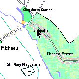
The area of the map coloured light green
is that contained within the "borough"
whose boundary was first recorded in 1327
(and not enlarged until municipal reform
in 1835). From at least the early 13th
century the borough was served by its own
court, separate from the Abbeys holdings
in the rest of its Liberty, which
consisted of a large area of the county,
and some Buckinghamshire manors.
Objects found in the Medieval Town may
be seen in The
Museum of St. Albans in Hatfield
Road.
|
You
can navigate around the town
using the map below or by using
the links in the Index (site map)
at the bottom of the page. This
will generally take you to a more
detailed map which you can use to
navigate to more detail or you
can scroll down the
page.
|
|
|